
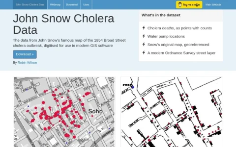
This site provides a digitised version of John Snow’s map of the 1854 Broad Street cholera outbreak, one of the foundational documents in epidemiology and medical cartography. Rather than presenting the map only as a historical image, the project converts its contents into data layers that can be loaded into contemporary GIS software.
The dataset bundles several components: cholera deaths recorded as points with associated counts, the locations of water pumps, a georeferenced copy of Snow’s original map, and a modern Ordnance Survey street layer for context. A web map offers a quick visual check, while a download section supplies the files for offline analysis.
It is aimed at historians of medicine, public-health researchers, epidemiology instructors, and GIS practitioners who want a compact, well-known case study for spatial analysis or classroom demonstration. Students learning about disease clustering and mapping will also find it useful.
To get started, preview the layers on the web map, then download the dataset and open it in your preferred GIS application. Check the Uses page for guidance on attribution and appropriate applications. Overall, it is a focused scholarly resource that makes a classic map reusable for modern spatial work.


评论与评分
0还没有评论,来写下第一条评价吧。