
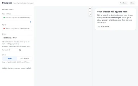
Dovepass is a research prototype built around a single question: can I fly this drone flight in San Francisco? Instead of reading scattered airspace maps and rule documents, you pick a takeoff point and a destination on the map, choose your drone, payload, battery and time, and the site evaluates the route against Part 107 licensed rules.
The core output is a clear answer with what you need to do, backed by a side-view chart of height along the route and numbered areas explaining what happens at each segment. It accounts for height, battery reserve and round trips, and flags areas with their own rules. Results can be exported as a DJI app file, files for other drone apps, a printable flight card or a map file.
It suits licensed drone pilots, hobbyists planning flights in San Francisco, and researchers or developers curious about rule-based flight checking. Because coverage is limited to San Francisco and the project is a prototype, it works best as a pre-flight sanity check rather than a replacement for official airspace authorization.
To get useful results, set an accurate takeoff and landing point, confirm your drone model and battery, and pick the actual flight time since night operations are handled differently. Re-run the check whenever inputs change, and use the exported flight card as a field reference.
评论与评分
0还没有评论,来写下第一条评价吧。