
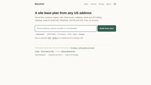
Basesheet is a free web tool that produces planning-level site base plans for any US address. Instead of manually assembling parcel data, topography and environmental layers from county, state and federal sources, users enter an address and receive a consolidated base plan ready for common design software.
The core output combines parcel lines, LiDAR-derived contours and slopes, soils, FEMA flood zones, wetlands, aerial imagery and 3D building massing. Files can be exported as DXF for AutoCAD, SketchUp terrain, LandXML for Civil 3D, GIS formats and PDF. Users can adjust contour intervals, set a buffer around the parcel, choose default or NCS-style layer naming, and edit layer names directly in the browser.
It is aimed at architects, land planners, civil engineers, landscape designers, real estate developers and students who need quick site context for feasibility studies, test fits and early concept design. The experimental apartment test fit option hints at early-stage massing workflows.
Because the data is planning-level and drawn from public sources, it should not replace a boundary or topographic survey for permitting or construction. Users should verify parcel lines, flood zones and wetlands against authoritative local records. The service is US-only, requires no account, and saves layer preferences in the browser.
Overall, Basesheet is a practical starting point for site research that saves hours of data gathering before more precise survey work begins.




Comments & Ratings
0No comments yet. Be the first to review.